Resight - 3D Mapping

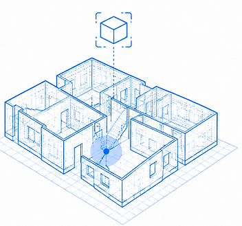
Modern operations often take place in environments where GPS is unavailable and existing maps are incomplete or outdated. Resight creates a live 3D map of the environment using the cameras already available on drones, ground robots and tactical devices.
The system uses SLAM technology to build and continuously update a detailed 3D representation of the area as teams move through it. Multiple devices can contribute to the same map, allowing operators to share information and understand their surroundings without relying on GPS.
Resight is software based and can run on existing commercial and tactical hardware without requiring additional LiDAR sensors. Processing takes place at the edge, which allows the system to continue working when connectivity is limited.
For military and security operations, Resight can support reconnaissance, EOD, close quarter operations, infrastructure inspection and missions in complex or underground environments. By giving teams a shared 3D view of their surroundings, Resight helps operators understand the environment and make better decisions in the field.